
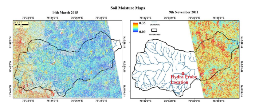
A satellite-only algorithm (which does not need ancillary data on soil surface roughness and vegetation) to retrieve soil moisture is tested over ambhas site (www.ambhas.com) in India. The satellite data used is L-band ALOS PALSAR which has all weather capability. The estimated soil moisture had a spatial resolution of 25 m capable of estimating crop water stress in small farms also. The estimated soil moisture can be used to address hydrological and agricultural applications that demand higher resolution information.
The details of the article are available at: http://www.aapahinnovations.com/publications/


Dr. Sat Kumar Tomer
The author is expert in the application of remote sensing for managing the natural resources.
Latest posts by Dr. Sat Kumar Tomer (see all)
- Publication: Groundwater Level Dynamics in Bengaluru City, India - December 26, 2017
- Publication: A Framework for Assessment of Climate Change Impacts on Groundwater System Formations - December 22, 2017
- Snap into which part of Uttar Pradesh,crops are under water stress - October 15, 2017