January 16, 2017January 2, 2018Algorithm Development, Geospatial Modelling, GIS solutions, News, Satellite Remote Sensing, Validation of satellite retrieved variables Publication: High Resolution Land Surface Geophysical Parameters Estimation from ALOS PALSAR data 
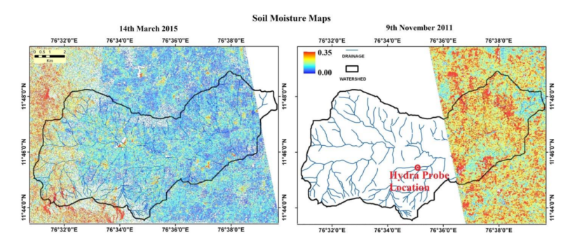
A satellite-only algorithm (which does not need ancillary data on soil surface roughness and vegetation) to retrieve soil moisture is tested over […]
January 12, 2017January 16, 2017News Estimation of a higher spatio-temporal resolution soil moisture over Karnataka MAPSM algorithm has been applied in the state of Karnataka to retrieve the higher resolution soil moisture. SMOS has been used for […]
September 20, 2016May 5, 2017consult, News Mapping groundwater using remote sensing data and GIS Groundwater is an important source of the fresh water for drinking and irrigation purposes. For the suistainable management of groundwater resources, scientific […]