


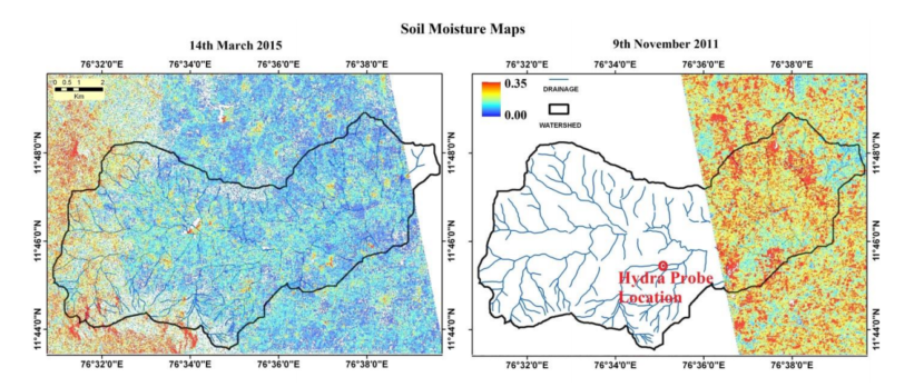
A satellite-only algorithm (which does not need ancillary data on soil surface roughness and vegetation) to retrieve soil moisture is tested over ambhas site (www.ambhas.com) in India. The satellite data used is L-band ALOS PALSAR which has all weather capability. The estimated soil moisture had a spatial resolution of 25 m capable of estimating crop water stress in small farms also. The estimated soil moisture can be used to address hydrological and agricultural applications that demand higher resolution information.
The details of the article are available at: http://www.aapahinnovations.com/publications/