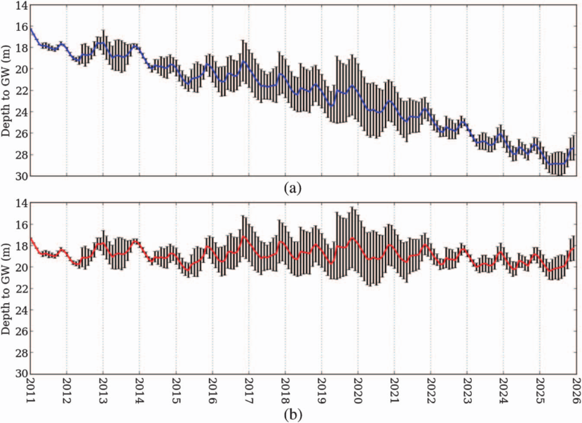
In order to understand the impact of climate change on vegetation and soil on the groundwater system comprehensively, complex coupled models that require a series of estimated parameters were run in a distributed framework for a catchment. The simple and general approach used to investigate the potential impact of climate change on groundwater fluxes forces future projections of precipitation and temperature from the global climate models (GCM) into an established groundwater model for a watershed or region. This chapter presents a methodology for modeling groundwater system under impacts of climate change. A 0.5℃ by 0.5℃ gridded groundwater level product was generated from the gauge datasets available in a particular grid, which were then modelled using AMBHAS-GW model. The method is applied and demonstrated on three 0.5℃ grids in the upper Cauvery Basin in southern India.
Complete chapter is available at: https://ascelibrary.org/doi/abs/10.1061/9780784414767.ch14


