

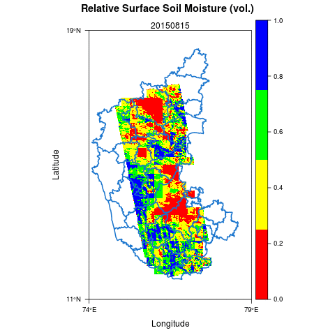
MAPSM algorithm has been applied in the state of Karnataka to retrieve the higher resolution soil moisture. SMOS has been used for the passive microwave data and RISAT-1 has been used for the active microwave data.
The high resolution soil moisture product can be used for several purposes e.g. identification of drought-impacted farmers and irrigation water management.


Dr. Sat Kumar Tomer
The author is expert in the application of remote sensing for managing the natural resources.
Latest posts by Dr. Sat Kumar Tomer (see all)
- Publication: Groundwater Level Dynamics in Bengaluru City, India - December 26, 2017
- Publication: A Framework for Assessment of Climate Change Impacts on Groundwater System Formations - December 22, 2017
- Snap into which part of Uttar Pradesh,crops are under water stress - October 15, 2017