Publication: A Spatio-Temporal Algorithm for Merging Soil Moisture from Active and Passive Microwave Remote Sensing

Posted on Posted in Agriculture, Algorithm Development, Disaster Management, Environment, Geospatial Modelling, GIS solutions, Mathematical Modelling, News, Satellite Remote Sensing, Validation of satellite retrieved variables, Water Resources

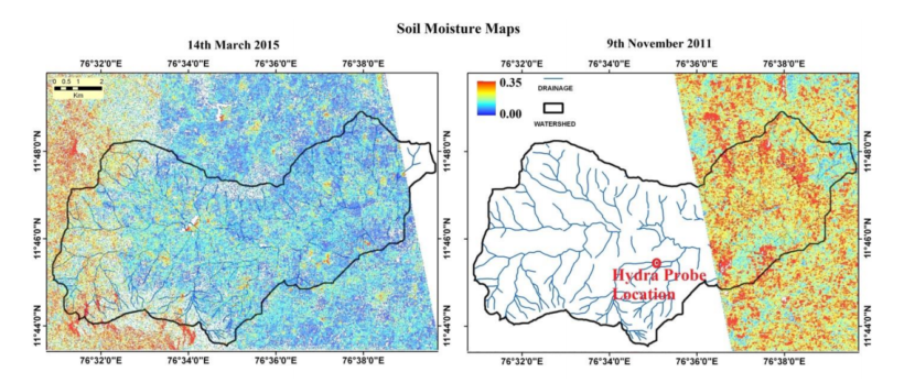
Currently the soil moisture is available either at coarse spatial scale from passive microwave remote sensing or at infrequent repeat time from active microwave remote sensing. A novel MAPSM algorithm is developed which merges Active and Passive microwave Soil Moisture to obtain a higher spatio-temporal soil moisture which is a prerequisite for various hydrological, agricultural and […]

Publication: High Resolution Land Surface Geophysical Parameters Estimation from ALOS PALSAR data

Posted on Posted in Algorithm Development, Geospatial Modelling, GIS solutions, News, Satellite Remote Sensing, Validation of satellite retrieved variables

A satellite-only algorithm (which does not need ancillary data on soil surface roughness and vegetation) to retrieve soil moisture is tested over ambhas site (www.ambhas.com) in India. The satellite data used is L-band ALOS PALSAR which has all weather capability. The estimated soil moisture had a spatial resolution of 25 m capable of estimating crop […]