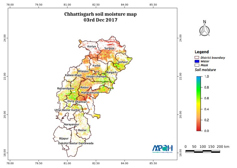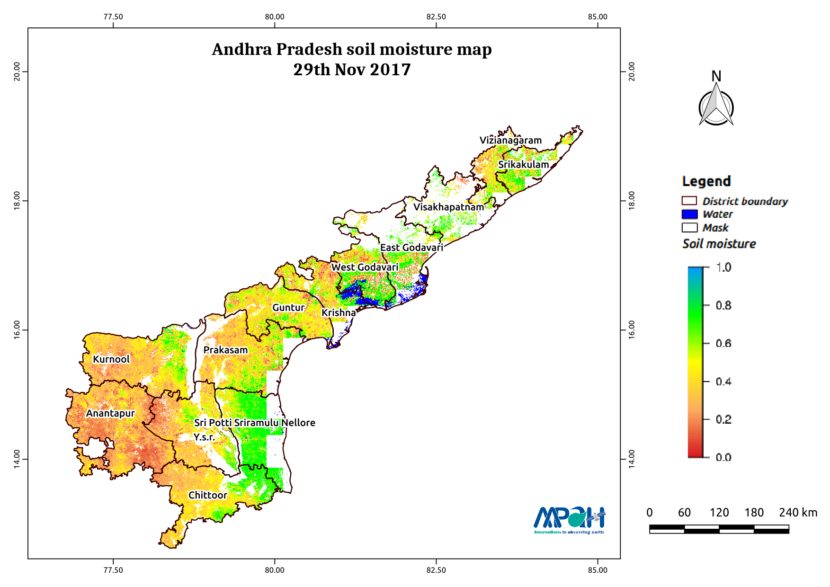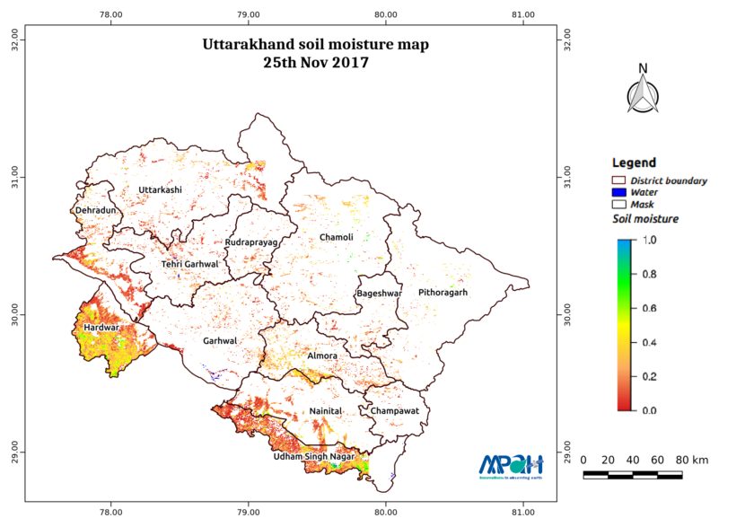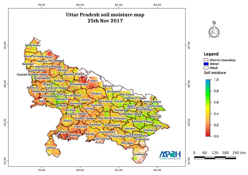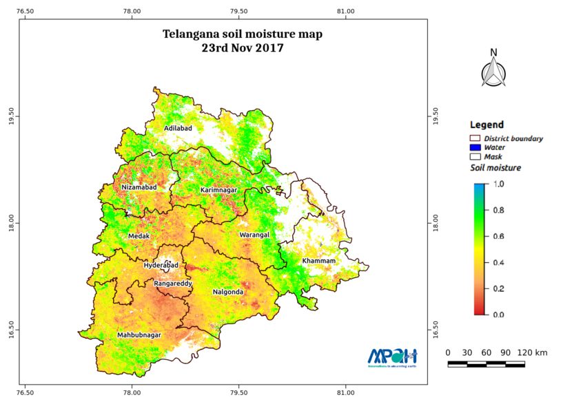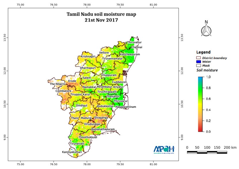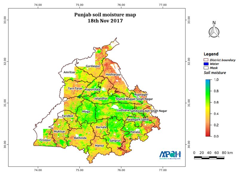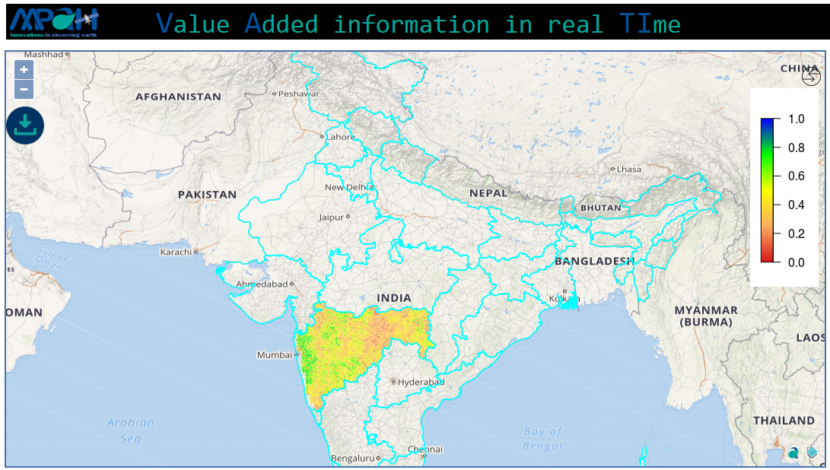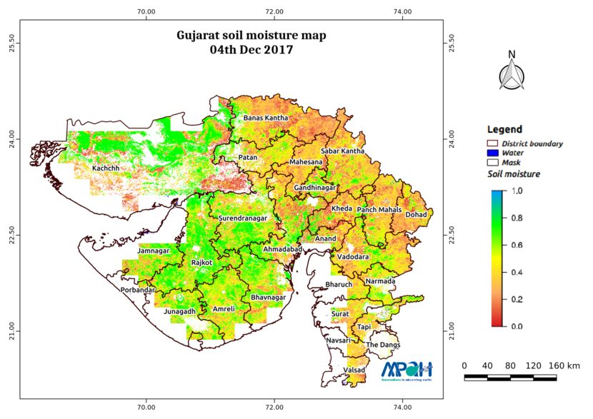
Soil Moisture Map for the state of Gujarat
The image shows the soil moisture map for Gujarat state. The map is prepared by merging microwave and optical satellite data using the algorithm developed by us. The soil moisture maps are available daily at a spatial resolution of 500 m. The developed near real time soil moisture is helpful for: Early warning of agricultural […]