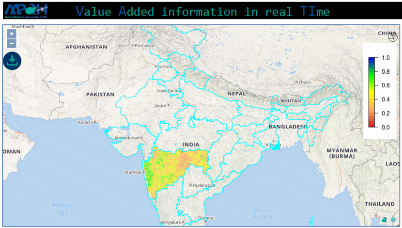
VATI – watch your region in real time through our new App

Posted on Posted in Agriculture, Algorithm Development, Environment, Geospatial Modelling, GIS solutions, Mathematical Modelling, Modelling, News, Remote Sensing, Satellite Remote Sensing, Software Development, Water Resources

Making it easier than ever to stay in touch with our selective innovative products and information which allows to observe earth in near real time. We have not only built the new flagship app but taken everything you would like i.e. more intuitive, smarter and dramatically simplify your remote sensing experience. VATI (Value Added information […]

Want to know how Turmeric is growing in your area?

Posted on Posted in agri, Agriculture, Crop insurance, Modelling, News, Remote Sensing, satellite, Satellite Remote Sensing

Advanced estimate of the crop yield is useful in various applications e.g. crop insurance, harvest planning, delivery estimates, etc. Advanced estimate of the crop yield can be obtained by performing the statistical analysis, however, it does not take into account the current ground realities and rely only on the historical data. The satellite remote sensing […]