


Making it easier than ever to stay in touch with our selective innovative products and information which allows to observe earth in near real time. We have not only built the new flagship app but taken everything you would like i.e. more intuitive, smarter and dramatically simplify your remote sensing experience.
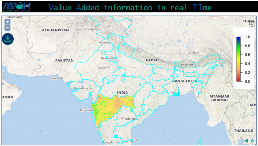
VATI (Value Added information in real TIme) is an application to visualize value-added information in real time. The value-added products/information is estimated by processing the data from multiple satellites. Currently, VATI streamlines the following core products:
i. Soil Moisture
ii. NDVI
iii. VCI
And, many more are coming soon!
You may register your VATI account for free at http://www.aapahinnovations.com/vati/.
Free edition includes:
(i) Visualization of the data in near real-time.
(ii) Chose any one geographical area.
(iii) Downloading of maps in png format.
Premium edition includes:
(i) All features of Free edition.
(ii) Download data in any GIS (raster/vector) format.
(iii) On-demand data processing for other time period/geographical area.
We are excited to have our new app in your hands. We look forward to your feedback and continuing to find new ways to help you in making your remote sensing experience simpler. If you want to know in detail how VATI is applicable anywhere across the globe, you can write to us at contact@aapahinnovations.com.
[cta id=”1542″ vid=”0″]