


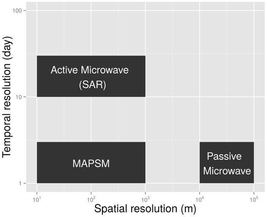
Currently the soil moisture is available either at coarse spatial scale from passive microwave remote sensing or at infrequent repeat time from active microwave remote sensing. A novel MAPSM algorithm is developed which merges Active and Passive microwave Soil Moisture to obtain a higher spatio-temporal soil moisture which is a prerequisite for various hydrological, agricultural and meteorological applications. The approach has been tested over the Berambadi watershed located in a semi-arid tropical region in the Karnataka state of south India. The algorithm is applied and validated using the RADARSAT-2 and in-situ soil moisture measurements during a period of 3 years spanning from 2010 to 2013. The results show that MAPSM is able to provide a good estimate of soil moisture.
The details of the article are available here.