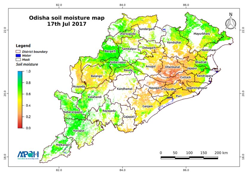
Soil Moisture Map for the state of Karnataka

Posted on Posted in Agriculture, Algorithm Development, Disaster Management, Environment, News, Satellite Remote Sensing, Water Resources

The image shows the soil moisture map for Karnataka state. The map is prepared by merging microwave and optical satellite data using the algorithm developed by us. The soil moisture maps are available daily at a spatial resolution of 500 m. The developed near real time soil moisture is helpful for: Early warning of agricultural […]

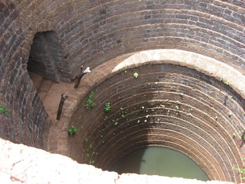
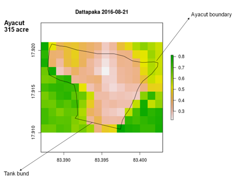
Is tank rehabilitation serving its purpose?

Posted on Posted in Agriculture, GIS solutions, News, Satellite Remote Sensing, Water Resources

Tanks are an important source of irrigation. Artificial or natural, tanks are used for harvesting and preserving the local rainfall and water from streams and rivers for later use for various purposes including agriculture and domestic. For serving the purpose, tanks require regular maintenance, revival, and restoration which includes frequent removal of silt (desilting). Also, […]

Soil Moisture Map for the state of Karnataka

Posted on Posted in Agriculture, Algorithm Development, Disaster Management, Environment, News, Satellite Remote Sensing, Water Resources

The image shows the soil moisture map for Karnataka state. The map is prepared by merging microwave and optical satellite data using the algorithm developed by us. The soil moisture maps are available daily at a spatial resolution of 500 m. The developed near real time soil moisture is helpful for: Early warning of agricultural […]
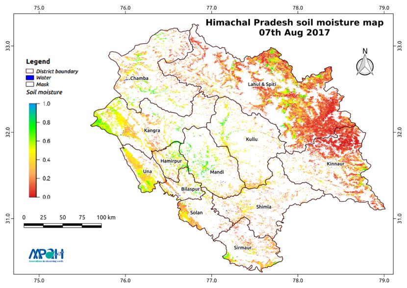
Soil Moisture Map for the state of Himachal Pradesh

Posted on Posted in Agriculture, Algorithm Development, Disaster Management, Environment, News, Satellite Remote Sensing, Water Resources

The image shows the soil moisture map for Himachal Pradesh state. The map is prepared by merging microwave and optical satellite data using the algorithm developed by us. The soil moisture maps are available daily at a spatial resolution of 500 m. The developed near real time soil moisture is helpful for: Early warning of […]

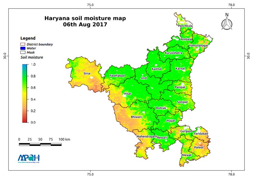
Soil Moisture Map for the state of Haryana

Posted on Posted in Agriculture, Algorithm Development, Disaster Management, Environment, News, Satellite Remote Sensing, Water Resources

The image shows the soil moisture map for Haryana state. The map is prepared by merging microwave and optical satellite data using the algorithm developed by us. The soil moisture maps are available daily at a spatial resolution of 500 m. The developed near real time soil moisture is helpful for: Early warning of agricultural […]
A novel distributed groundwater model for hard rock aquifers

Posted on Posted in Mathematical Modelling, News, Water Resources

Groundwater accounts for approximately 30% of the global freshwater and is a major source of drinking water in both urban and rural areas. It is also an important source of water for the agricultural and industrial sector. The groundwater dynamics is controlled by several factors e.g. recharge due to rainfall, recharge due to leakage in […]

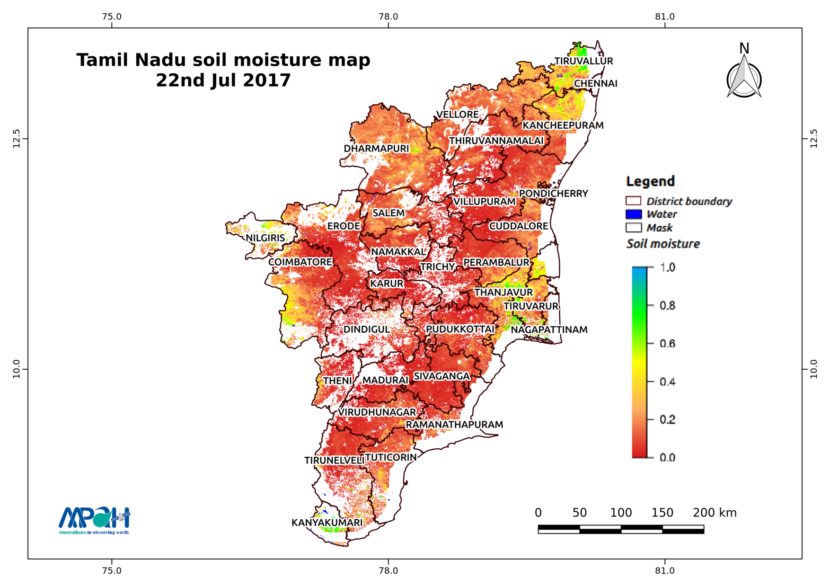
Soil Moisture Map for the state of Tamil Nadu

Posted on Posted in Agriculture, Algorithm Development, Disaster Management, Environment, News, Satellite Remote Sensing, Water Resources

The image shows the soil moisture map for Tamil Nadu state. The map is prepared by merging microwave and optical satellite data using the algorithm developed by us. The soil moisture maps are available daily at a spatial resolution of 500 m. The developed near real time soil moisture is helpful for: Early warning of […]

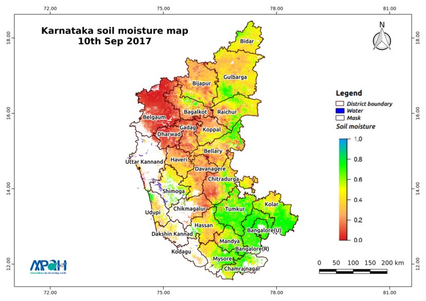
Soil Moisture Map for the state of Odisha

Posted on Posted in Agriculture, Algorithm Development, Disaster Management, Environment, News, Satellite Remote Sensing, Water Resources

The image shows the soil moisture map for Odisha state. The map is prepared by merging microwave and optical satellite data using the algorithm developed by us. The soil moisture maps are available daily at a spatial resolution of 500 m. The developed near real time soil moisture is helpful for: Early warning of agricultural […]

Soil Moisture Map for the state of Tamil Nadu

Posted on Posted in Agriculture, Algorithm Development, Disaster Management, Environment, News, Satellite Remote Sensing, Water Resources

The image shows the soil moisture map for Tamil Nadu state. The map is prepared by merging microwave and optical satellite data using the algorithm developed by us. The soil moisture maps are available daily at a spatial resolution of 500 m. The developed near real time soil moisture is helpful for: Early warning of […]

Soil Moisture Map for the state of Telangana

Posted on Posted in Agriculture, Algorithm Development, Disaster Management, Environment, News, Satellite Remote Sensing, Water Resources

The image shows the soil moisture map for Telangana state. The map is prepared by merging microwave and optical satellite data using the algorithm developed by us. The soil moisture maps are available daily at a spatial resolution of 500 m. The developed near real time soil moisture is helpful for: Early warning of agricultural […]