Soil Moisture Map for the state of Himachal Pradesh

Posted on Posted in Agriculture, Algorithm Development, Disaster Management, Environment, News, Satellite Remote Sensing, Water Resources

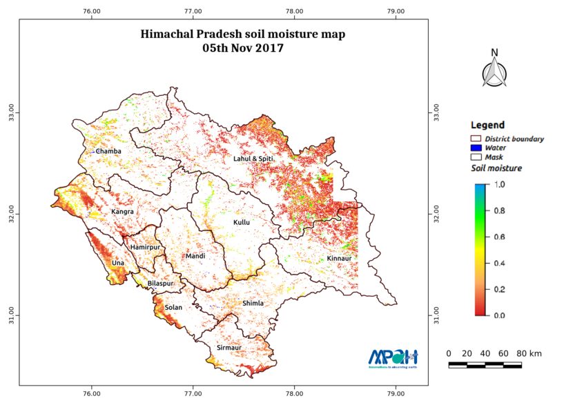
The image shows the soil moisture map for Himachal Pradesh state. The map is prepared by merging microwave and optical satellite data using the algorithm developed by us. The soil moisture maps are available daily at a spatial resolution of 500 m. The developed near real time soil moisture is helpful for: Early warning of […]

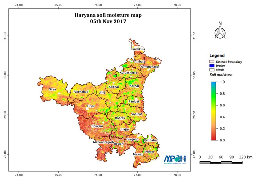
Soil Moisture Map for the state of Haryana

Posted on Posted in Agriculture, Algorithm Development, Disaster Management, Environment, News, Satellite Remote Sensing, Water Resources

The image shows the soil moisture map for Haryana state. The map is prepared by merging microwave and optical satellite data using the algorithm developed by us. The soil moisture maps are available daily at a spatial resolution of 500 m. The developed near real time soil moisture is helpful for: Early warning of agricultural […]

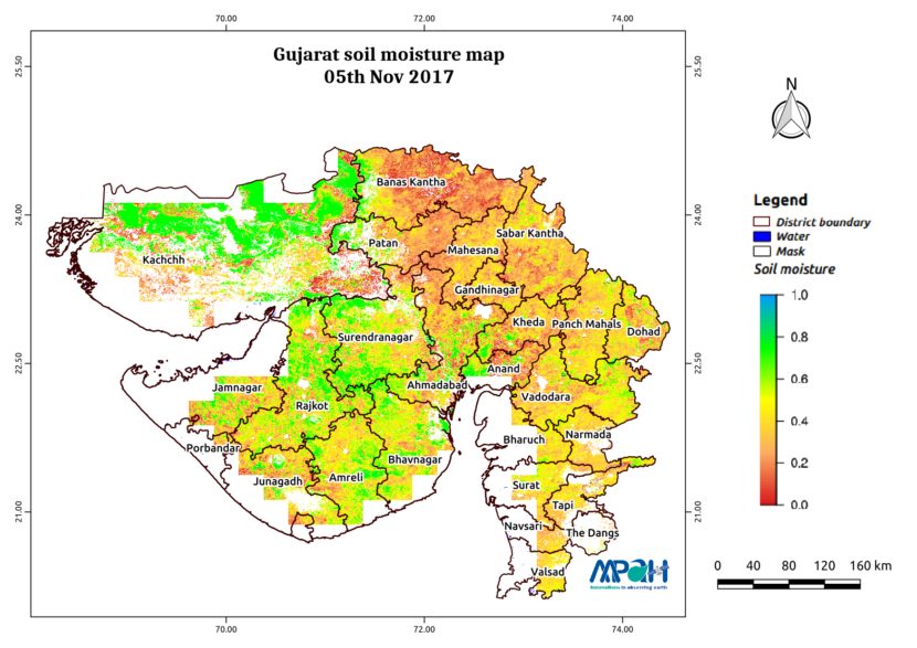
Soil Moisture Map for the state of Gujarat

Posted on Posted in Agriculture, Algorithm Development, Disaster Management, Environment, News, Satellite Remote Sensing, Water Resources

The image shows the soil moisture map for Gujarat state. The map is prepared by merging microwave and optical satellite data using the algorithm developed by us. The soil moisture maps are available daily at a spatial resolution of 500 m. The developed near real time soil moisture is helpful for: Early warning of agricultural […]

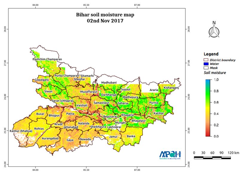
Soil Moisture Map for the state of Bihar

Posted on Posted in Agriculture, Algorithm Development, Disaster Management, Environment, News, Satellite Remote Sensing, Water Resources

The image shows the soil moisture map for Bihar state. The map is prepared by merging microwave and optical satellite data using the algorithm developed by us. The soil moisture maps are available daily at a spatial resolution of 500 m. The developed near real time soil moisture is helpful for: Early warning of agricultural […]

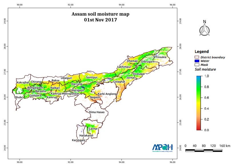
Soil Moisture Map for the state of Assam

Posted on Posted in Agriculture, Algorithm Development, Disaster Management, Environment, News, Satellite Remote Sensing, Water Resources

The image shows the soil moisture map for Assam state. The map is prepared by merging microwave and optical satellite data using the algorithm developed by us. The soil moisture maps are available daily at a spatial resolution of 500 m. The developed near real time soil moisture is helpful for: Early warning of agricultural […]

Soil Moisture Map for the state of Tamil Nadu

Posted on Posted in Agriculture, Algorithm Development, Disaster Management, Environment, News, Satellite Remote Sensing, Water Resources

The image shows the soil moisture map for Tamil Nadu state. The map is prepared by merging microwave and optical satellite data using the algorithm developed by us. The soil moisture maps are available daily at a spatial resolution of 500 m. The developed near real time soil moisture is helpful for: Early warning of […]
Soil Moisture Map for the state of Punjab

Posted on Posted in Agriculture, Algorithm Development, Disaster Management, Environment, News, Satellite Remote Sensing, Water Resources

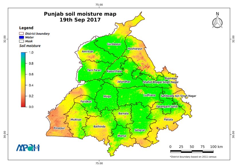
The image shows the soil moisture map for Punjab state. The map is prepared by merging microwave and optical satellite data using the algorithm developed by us. The soil moisture maps are available daily at a spatial resolution of 500 m. The developed near real time soil moisture is helpful for: Early warning of agricultural […]

Soil Moisture Map for the state of Odisha

Posted on Posted in Agriculture, Algorithm Development, Disaster Management, Environment, News, Satellite Remote Sensing, Water Resources

The image shows the soil moisture map for Odisha state. The map is prepared by merging microwave and optical satellite data using the algorithm developed by us. The soil moisture maps are available daily at a spatial resolution of 500 m. The developed near real time soil moisture is helpful for: Early warning of agricultural […]

Did crop get enough water in Maharashtra this Kharif season?

Posted on Posted in agri, Agriculture, Algorithm Development, Consultancy, Crop insurance, disaster, Disaster Management, satellite, Satellite Remote Sensing, Water Resources

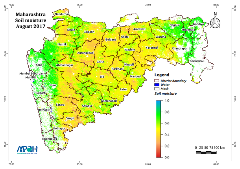
The Kharif season is approaching its end and the availability of water to crops in Maharashtra using Satellite microwave remote sensing reasonably be quantified. The satellite estimated daily soil moisture is converted into monthly average relative soil moisture for June-September 2017 as shown in the figures. During June, relative soil moisture varies from 0 to […]

Soil Moisture Map for the state of Punjab

Posted on Posted in Agriculture, Algorithm Development, Disaster Management, Environment, News, Satellite Remote Sensing, Water Resources

The image shows the soil moisture map for Punjab state. The map is prepared by merging microwave and optical satellite data using the algorithm developed by us. The soil moisture maps are available daily at a spatial resolution of 500 m. The developed near real time soil moisture is helpful for: Early warning of agricultural […]