
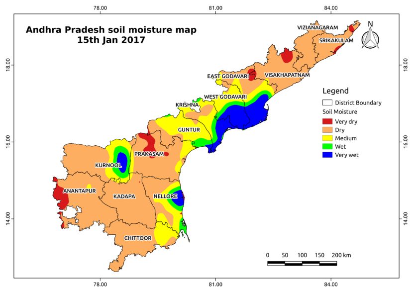
The image shows the soil moisture map for Andhra Pradesh state. The map is prepared by merging microwave and optical satellite date using algorithm developed by us. Soil moisture data is available at a spatial resolution of 500 m and temporal resolution of one day. To avail the soil moisture data contact us


Latest posts by Thiyaku S. (see all)
- Soil Moisture Map for the state of Kerala - February 13, 2018
- Soil Moisture Map for the state of Jharkhand - February 11, 2018
- Soil Moisture Map for the state of Haryana - February 8, 2018