Groundwater is an important source of the fresh water for drinking and irrigation purposes. For the suistainable management of groundwater resources, scientific assessment is essential. Remote sensing provides a way to quickly assess the groundwater resources for the large region, which is cumbersome and costly with manual measurements.
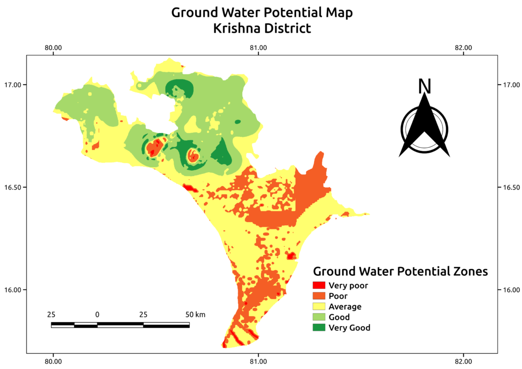
Remote sensing based GIS layers can be used to identify the groundwater potential map. Groundwater potential zones are identified using the lineament density and hydrogeomorphology (Landuse/landcover, drainage map, slope map, rainfall and soil type) data. Above figure shows the groundwater potential map for Krishna district, Andhra Pradesh.
The information of groundwater potential zones will be useful in various applications of groundwater resources management e.g. identifying potential sites of RO borewell plants for drinking purpose, identification of borewell area for urban water supply.


