

Knowledge of higher spatial resolution soil moisture is of paramount importance in agriculture, water resource management, flood, drought, etc. Soil moisture has a high spatial variability due to the variability in soil, vegetation and climate. Soil moisture can be measured using soil moisture sensors, however these measurements are point based and not feasible to cover large area.
Microwave remote sensing, particularly the lower frequency part, provides suitable option for soil moisture estimation in all weather conditions for larger scale. Microwave reflectance directly proportional to soil dielectric constant and so as moisture content.
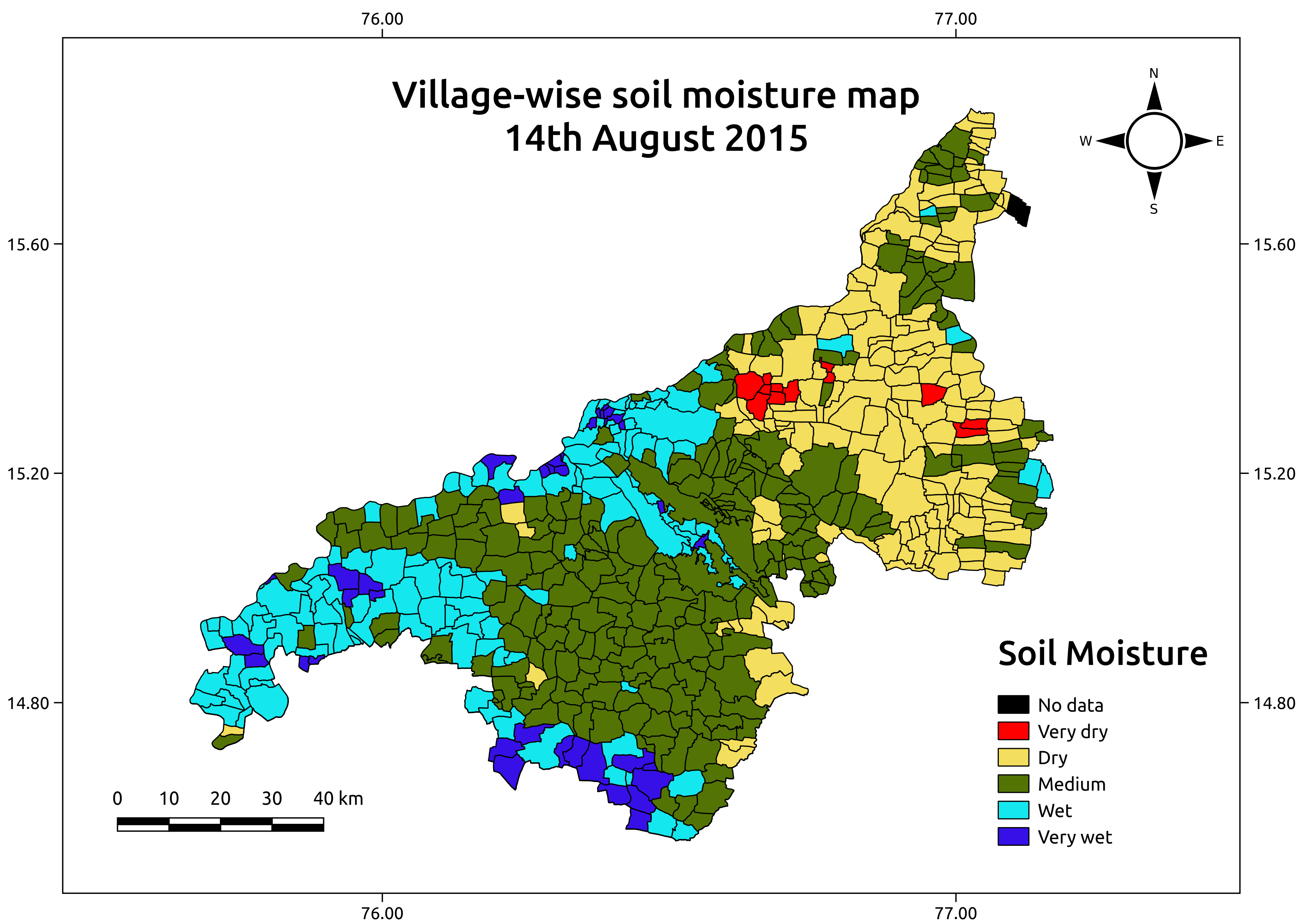
We have developed algorithms to estimate soil moisture using the RISAT-1 (active microwave satellite) data. The advantage of model is that it does not require site specific calibration and hence can be easily applied to other areas. We have tested our model extensively in Karnataka state. Below figures show the village-wise soil moisture map for Bellary district.


admin
Latest posts by admin (see all)
- Publication: Groundwater Level Dynamics in Bengaluru City, India - December 26, 2017
- Publication: A Framework for Assessment of Climate Change Impacts on Groundwater System Formations - December 22, 2017
- Snap into which part of Uttar Pradesh,crops are under water stress - October 15, 2017