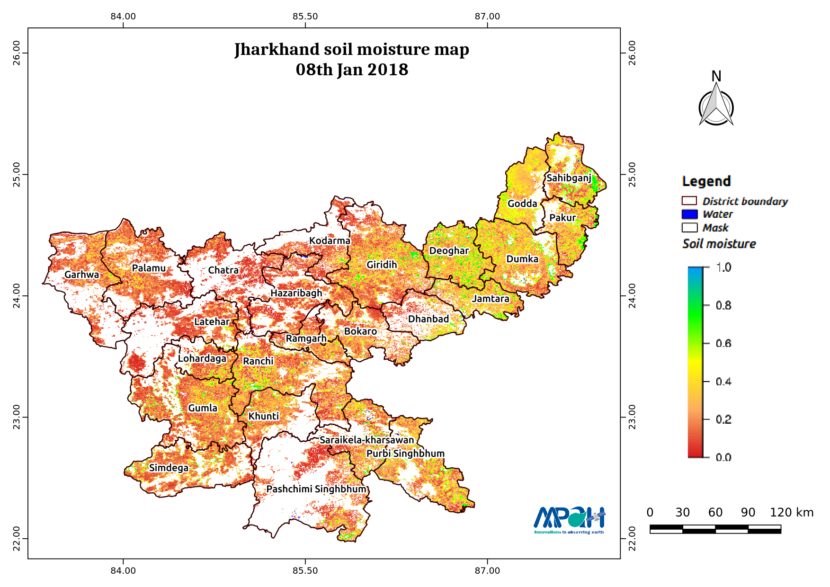
Soil Moisture Map for the state of Jharkhand

Posted on Posted in Agriculture, Algorithm Development, Disaster Management, Environment, News, Satellite Remote Sensing, Water Resources

The image shows the soil moisture map for Jharkhand state for 08-Jan-2018. The map is prepared by merging data from multiple satellites using the vikleda algorithm. Some of the applications where soil moisture is useful are: Optimal irrigation in farms Identify areas being over-irrigated Improved flood risk estimation Monitor agricultural drought in near real time […]

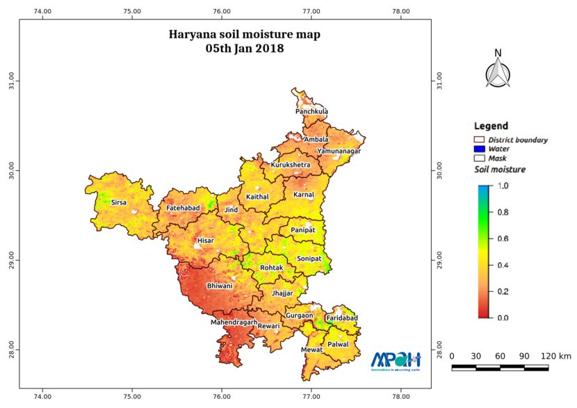
Soil Moisture Map for the state of Haryana

Posted on Posted in Agriculture, Algorithm Development, Disaster Management, Environment, News, Satellite Remote Sensing, Water Resources

The image shows the soil moisture map for Haryana state for 05-Jan-2018. The map is prepared by merging data from multiple satellites using the vikleda algorithm. Some of the applications where soil moisture is useful are: Optimal irrigation in farms Identify areas being over-irrigated Improved flood risk estimation Monitor agricultural drought in near real time […]
Soil Moisture Map for the state of Chhattisgarh

Posted on Posted in Agriculture, Algorithm Development, Disaster Management, Environment, News, Satellite Remote Sensing, Water Resources

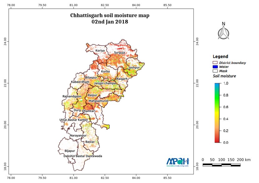
The image shows the soil moisture map for Chhattisgarh state for 02-Jan-2018. The map is prepared by merging data from multiple satellites using the vikleda algorithm. Some of the applications where soil moisture is useful are: Optimal irrigation in farms Identify areas being over-irrigated Improved flood risk estimation Monitor agricultural drought in near real time […]
Soil Moisture Map for the state of Bihar

Posted on Posted in Agriculture, Algorithm Development, Disaster Management, Environment, News, Satellite Remote Sensing, Water Resources

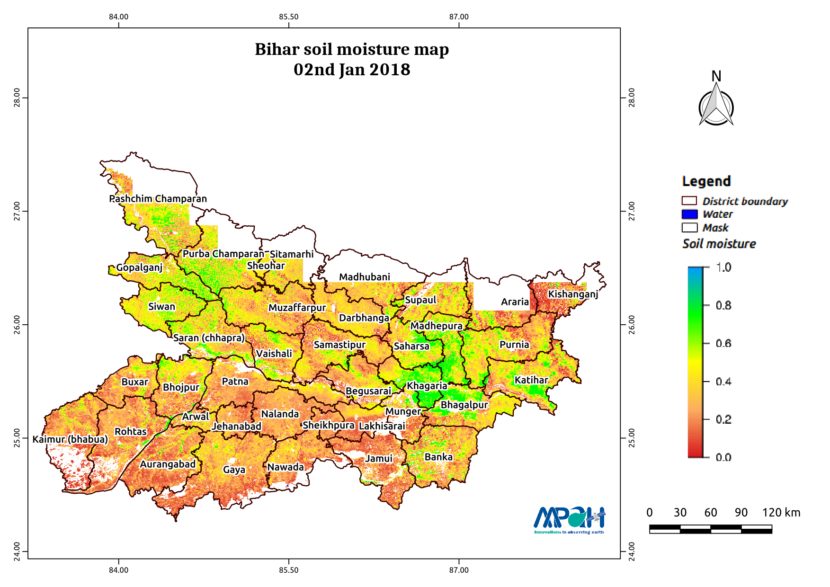
The image shows the soil moisture map for Bihar state for 02-Jan-2018. The map is prepared by merging data from multiple satellites using the vikleda algorithm. Some of the applications where soil moisture is useful are: Optimal irrigation in farms Identify areas being over-irrigated Improved flood risk estimation Monitor agricultural drought in near real time […]
Soil Moisture Map for the state of Assam

Posted on Posted in Agriculture, Algorithm Development, Disaster Management, Environment, News, Satellite Remote Sensing, Water Resources

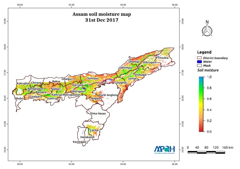
The image shows the soil moisture map for Assam state for 31-Dec-2017. The map is prepared by merging data from multiple satellites using the vikleda algorithm. Some of the applications where soil moisture is useful are: Optimal irrigation in farms Identify areas being over-irrigated Improved flood risk estimation Monitor agricultural drought in near real time […]
Soil Moisture Map for the state of Andhra Pradesh

Posted on Posted in Agriculture, Algorithm Development, Disaster Management, Environment, News, Satellite Remote Sensing, Water Resources

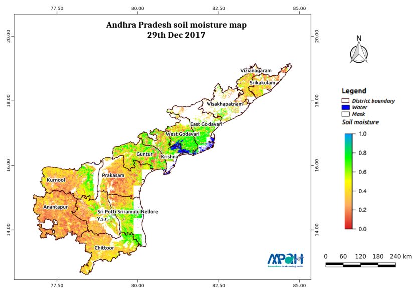
The image shows the soil moisture map for Andhra Pradesh state. The map is prepared by merging microwave and optical satellite data using the algorithm developed by us. The soil moisture maps are available daily at a spatial resolution of 500 m. The developed near real time soil moisture is helpful for: Early warning of […]

Publication: Groundwater Level Dynamics in Bengaluru City, India

Posted on Posted in Consultancy, GIS solutions, Mathematical Modelling, News, Urban planning

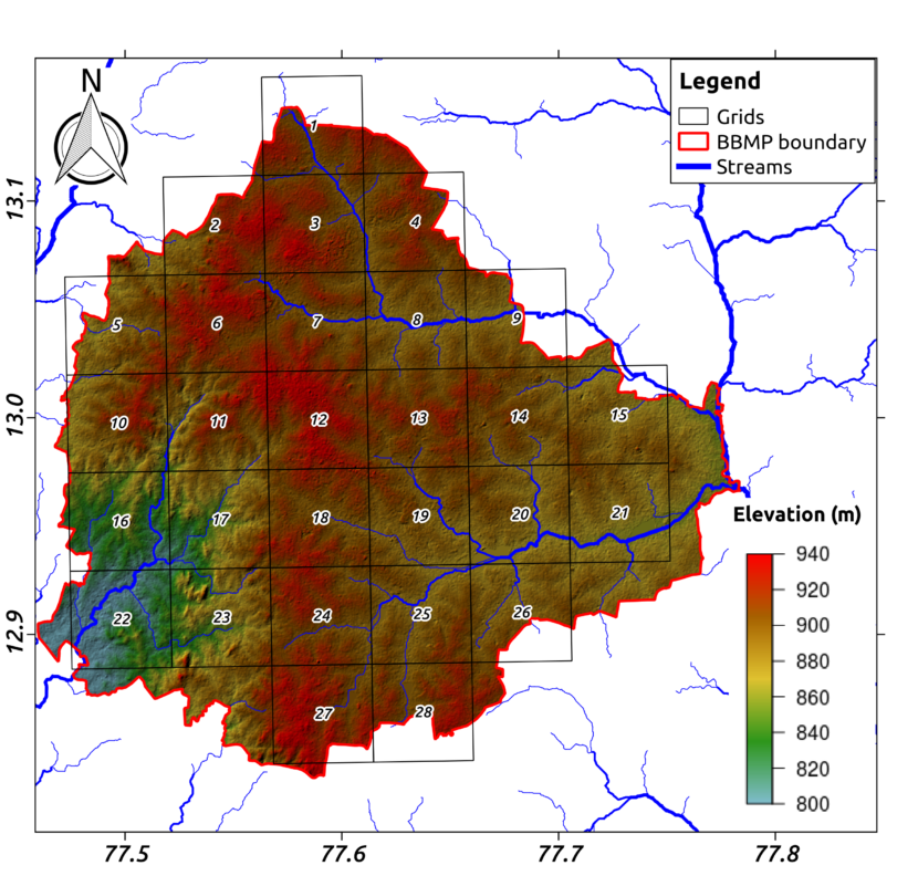
Groundwater accounts for half of Indian urban water use. However, little is known about its sustainability, because of inadequate monitoring and evaluation. We deployed a dense monitoring network in 154 locations in Bengaluru, India between 2015 and 2017. Groundwater levels collected at these locations were analyzed to understand the behavior of the city’s groundwater system. […]

Soil Moisture Map for the state of Telangana

Posted on Posted in Agriculture, Algorithm Development, Disaster Management, Environment, News, Satellite Remote Sensing, Water Resources

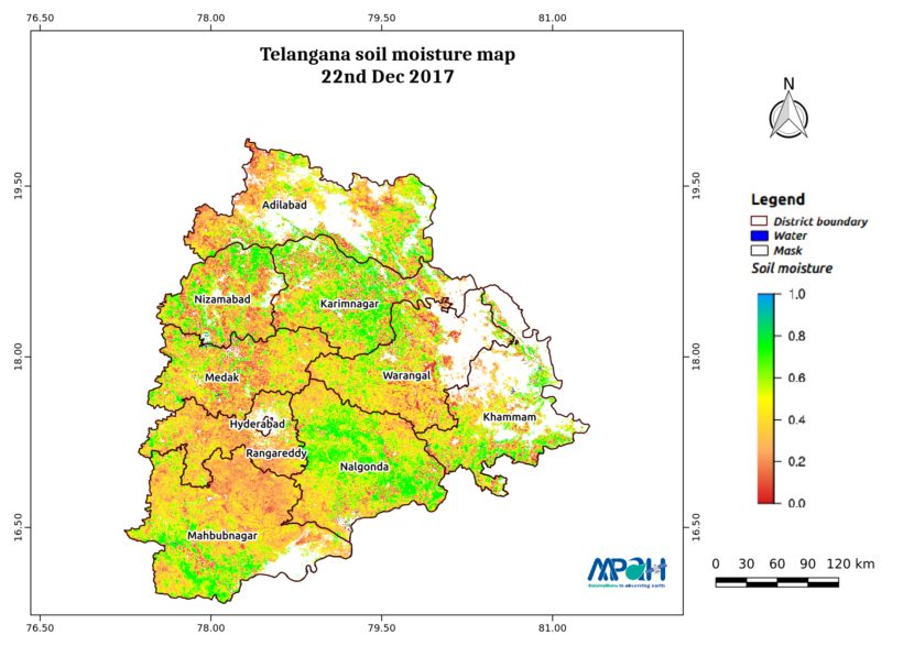
The image shows the soil moisture map for Telangana state. The map is prepared by merging microwave and optical satellite data using the algorithm developed by us. The soil moisture maps are available daily at a spatial resolution of 500 m. The developed near real time soil moisture is helpful for: Early warning of agricultural […]

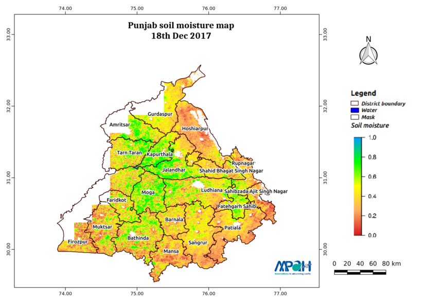
Soil Moisture Map for the state of Punjab

Posted on Posted in Agriculture, Algorithm Development, Disaster Management, Environment, News, Satellite Remote Sensing, Water Resources

The image shows the soil moisture map for Punjab state. The map is prepared by merging microwave and optical satellite data using the algorithm developed by us. The soil moisture maps are available daily at a spatial resolution of 500 m. The developed near real time soil moisture is helpful for: Early warning of agricultural […]

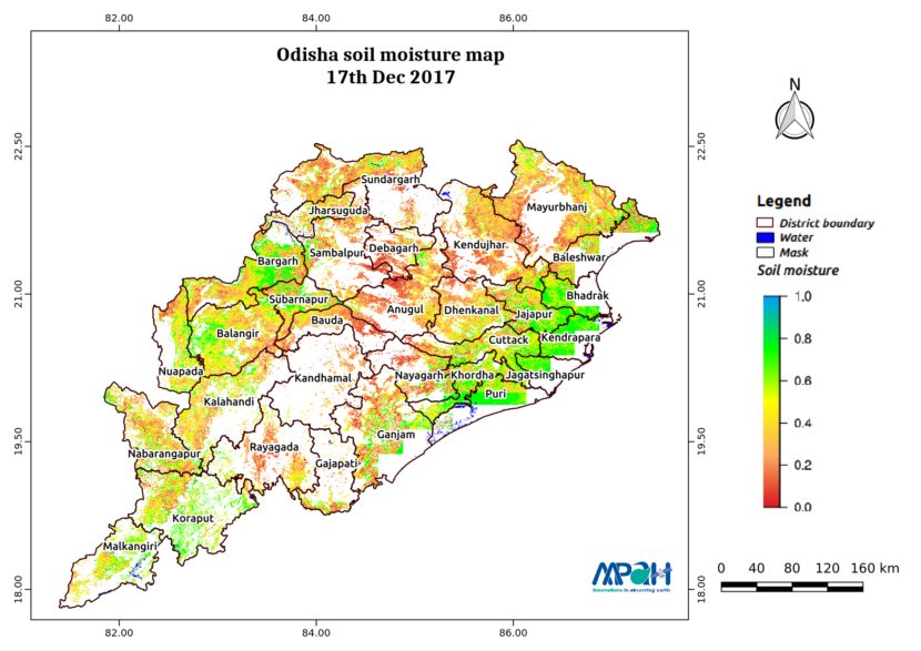
Soil Moisture Map for the state of Odisha

Posted on Posted in Agriculture, Algorithm Development, Disaster Management, Environment, News, Satellite Remote Sensing, Water Resources

The image shows the soil moisture map for Odisha state. The map is prepared by merging microwave and optical satellite data using the algorithm developed by us. The soil moisture maps are available daily at a spatial resolution of 500 m. The developed near real time soil moisture is helpful for: Early warning of agricultural […]