


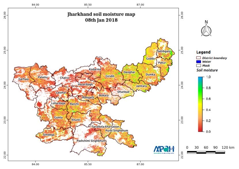
The image shows the soil moisture map for Jharkhand state for 08-Jan-2018. The map is prepared by merging data from multiple satellites using the vikleda algorithm.
Some of the applications where soil moisture is useful are:
- Optimal irrigation in farms
- Identify areas being over-irrigated
- Improved flood risk estimation
- Monitor agricultural drought in near real time
- Improved weather forecast
- Analyse the impact of an irrigation project
- Identify the irrigated area by an irrigation source
- Automatic billing of farm based on the actual irrigation
- Estimation of actual evapotranspiration taking place
- Estimation of area getting degraded
To watch your region in real time, please check our app VATI.
[cta id=”1542″ vid=”0″]