


Soil moisture is of paramount importance in various applications e.g. hydrology, agriculture and meteorology. Some of the application where soil moisture is useful are:
- Optimal irrigation in farms
- Identify areas being over-irrigated
- Improved flood risk estimation
- Monitor agricultural drought in near real time
- Improved weather forecast
- Analyse the impact of an irrigation project
- Identify the irrigated area by an irrigation source
- Automatic billing of farm based on the actual irrigation
- Estimation of actual evapotranspiration taking place
- Estimation of area getting degraded
The soil moisture can be measured using ground observations manually, sensors and satellite remote sensing. Manual method requires a lot of man time and is not effective for continuous measurement over the large area. Sensors can provide continuous measurements, however, they are expensive and provide information over a point only. The satellite-based method provides an economical way to estimate the soil moisture over the large area continuously.
Soil moisture from the satellite can be obtained from visible and infrared data, passive microwave data or active microwave data. Visible and infrared data provides soil moisture at fine spatial resolution but has limited ability to penetrate clouds and are infrequent. Passive microwave data can provide soil moisture at higher temporal resolution but has a coarse spatial resolution (~40 km). Active microwave data provides fine spatial resolution but has infrequent coverage ((Moran M. S., Peters-Lidard C. D., Watts J. M. & McElroy S (2004). Estimating soil moisture at the watershed scale with satellite-based radar and land surface models. Can. J. Remote Sensing, 30, 5, 806-825.)). Since most of the soil moisture data from the satellite are available at either fine spatial resolution (high temporal resolution) or coarse spatial resolution (low temporal resolution), they can not be used directly as most of the applications require soil moisture data at higher spatial and higher temporal resolution.
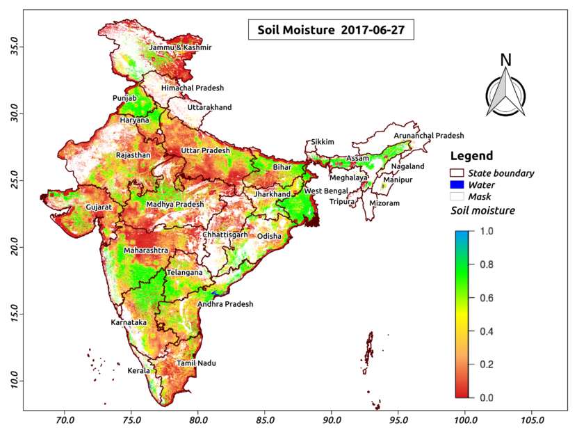
Aapah Innovations Pvt Ltd has developed an innovative algorithm to obtain soil moisture data at both higher spatial and temporal resolution by combining the multi-satellite data. As an example, a first of its kind of higher resolution soil moisture map over India is shown in above figure.
[cta id=”1542″ vid=”0″]