


Drought is a normal and recurrent feature of climate. Droughts are classified into three categories viz. meteorological, hydrological and agricultural. Meteorological drought is identified by the estimate of the departure of precipitation from normal. Hydrological droughts indicate the departure of surface and ground water from normal. Agricultural droughts are caused by inadequate soil moisture to support the growth of a crop, resulting in the wilting of a crop. Thus, agricultural drought is the effect of hydrological drought on crops.
Assessment of drought is required for taking timely remedial measures to improve the situation. Normalised Difference Vegetation Index (NDVI) is most widely used to detect the agricultural drought. However, NDVI only detects the agricultural drought when crops are already hit by it. At this stage, remedial measures can’t be taken. Soil moisture is a variable to early detect the agricultural drought before it has impacted the crops and take timely remedial measures. Satellite-based remote sensing can be used for early detection of agricultural drought.
Based on the 2010-11 census, a majority of farmers holds below 1 ha land in India. Hence, the identification of drought should be done at this size and at a maximum weekly frequency. However, currently available satellites which are sensitive to soil moisture either have a high temporal (daily revisit) or higher spatial (less than 1 ha) resolution. Aapah Innovations has developed the soil moisture products by combining data from multiple satellites to provide a higher spatio-temporal (less than 1 ha at the daily frequency) soil moisture product. This product can be used to detect drought at the farm scale and monitor the area continuously.
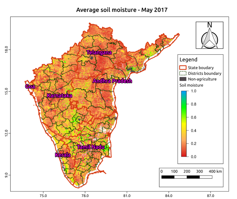
Aapah Innovations will track the drought conditions across India during the Kharif season. As an example, the average soil moisture in May over South India is shown in the figure.