Soil Moisture Map for the state of Bihar

Posted on Posted in Agriculture, Algorithm Development, Disaster Management, Environment, News, Satellite Remote Sensing, Water Resources

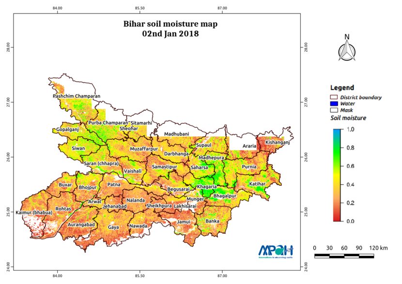
The image shows the soil moisture map for Bihar state for 02-Jan-2018. The map is prepared by merging data from multiple satellites using the vikleda algorithm. Some of the applications where soil moisture is useful are: Optimal irrigation in farms Identify areas being over-irrigated Improved flood risk estimation Monitor agricultural drought in near real time […]

Soil Moisture Map for the state of Assam

Posted on Posted in Agriculture, Algorithm Development, Disaster Management, Environment, News, Satellite Remote Sensing, Water Resources

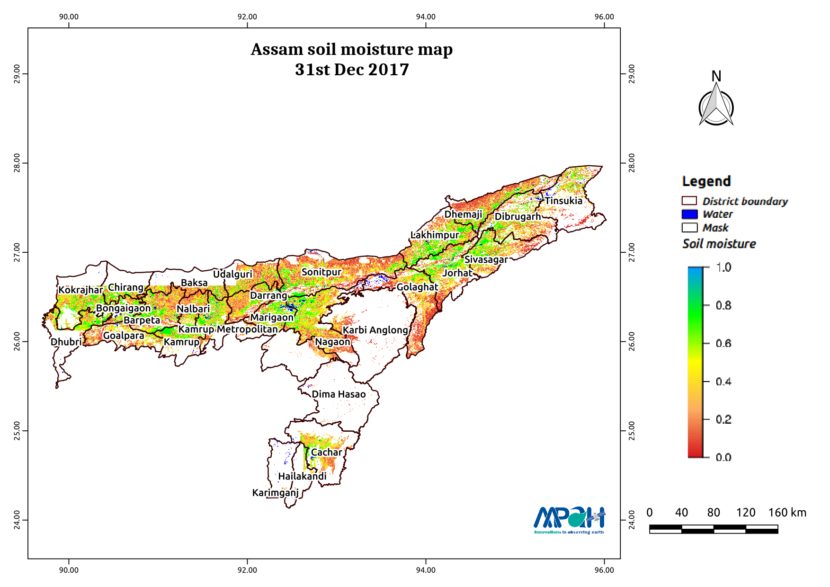
The image shows the soil moisture map for Assam state for 31-Dec-2017. The map is prepared by merging data from multiple satellites using the vikleda algorithm. Some of the applications where soil moisture is useful are: Optimal irrigation in farms Identify areas being over-irrigated Improved flood risk estimation Monitor agricultural drought in near real time […]
Soil Moisture Map for the state of Andhra Pradesh

Posted on Posted in Agriculture, Algorithm Development, Disaster Management, Environment, News, Satellite Remote Sensing, Water Resources

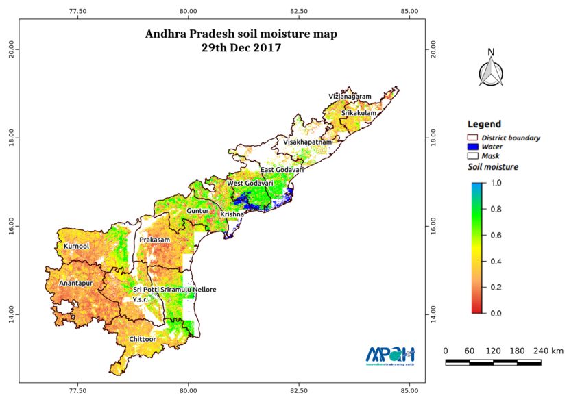
The image shows the soil moisture map for Andhra Pradesh state. The map is prepared by merging microwave and optical satellite data using the algorithm developed by us. The soil moisture maps are available daily at a spatial resolution of 500 m. The developed near real time soil moisture is helpful for: Early warning of […]

Soil Moisture Map for the state of Telangana

Posted on Posted in Agriculture, Algorithm Development, Disaster Management, Environment, News, Satellite Remote Sensing, Water Resources

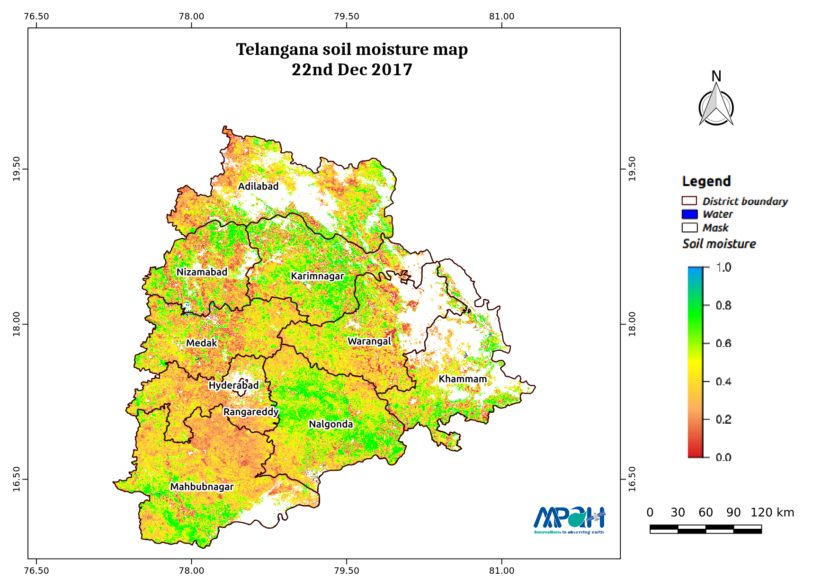
The image shows the soil moisture map for Telangana state. The map is prepared by merging microwave and optical satellite data using the algorithm developed by us. The soil moisture maps are available daily at a spatial resolution of 500 m. The developed near real time soil moisture is helpful for: Early warning of agricultural […]

Soil Moisture Map for the state of Punjab

Posted on Posted in Agriculture, Algorithm Development, Disaster Management, Environment, News, Satellite Remote Sensing, Water Resources

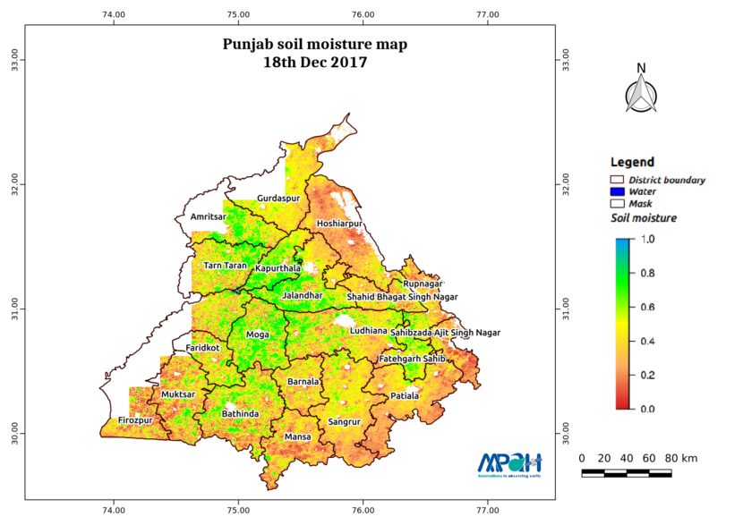
The image shows the soil moisture map for Punjab state. The map is prepared by merging microwave and optical satellite data using the algorithm developed by us. The soil moisture maps are available daily at a spatial resolution of 500 m. The developed near real time soil moisture is helpful for: Early warning of agricultural […]

Soil Moisture Map for the state of Odisha

Posted on Posted in Agriculture, Algorithm Development, Disaster Management, Environment, News, Satellite Remote Sensing, Water Resources

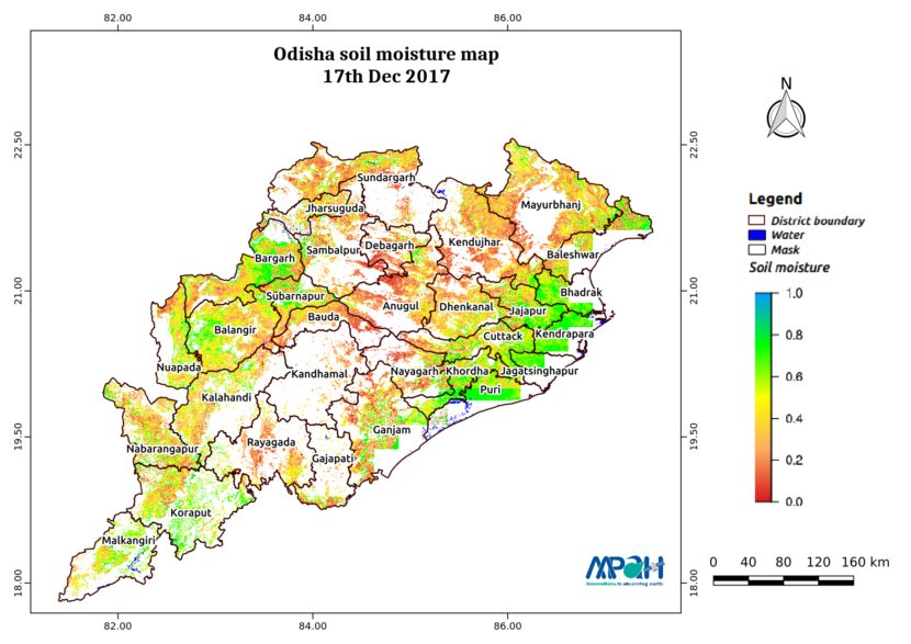
The image shows the soil moisture map for Odisha state. The map is prepared by merging microwave and optical satellite data using the algorithm developed by us. The soil moisture maps are available daily at a spatial resolution of 500 m. The developed near real time soil moisture is helpful for: Early warning of agricultural […]

Soil Moisture Map for the state of Kerala

Posted on Posted in Agriculture, Algorithm Development, Disaster Management, Environment, News, Satellite Remote Sensing, Water Resources

The image shows the soil moisture map for Kerala state. The map is prepared by merging microwave and optical satellite data using the algorithm developed by us. The soil moisture maps are available daily at a spatial resolution of 500 m. The developed near real time soil moisture is helpful for: Early warning of agricultural […]

Soil Moisture Map for the state of Himachal Pradesh

Posted on Posted in Agriculture, Algorithm Development, Disaster Management, Environment, News, Satellite Remote Sensing, Water Resources

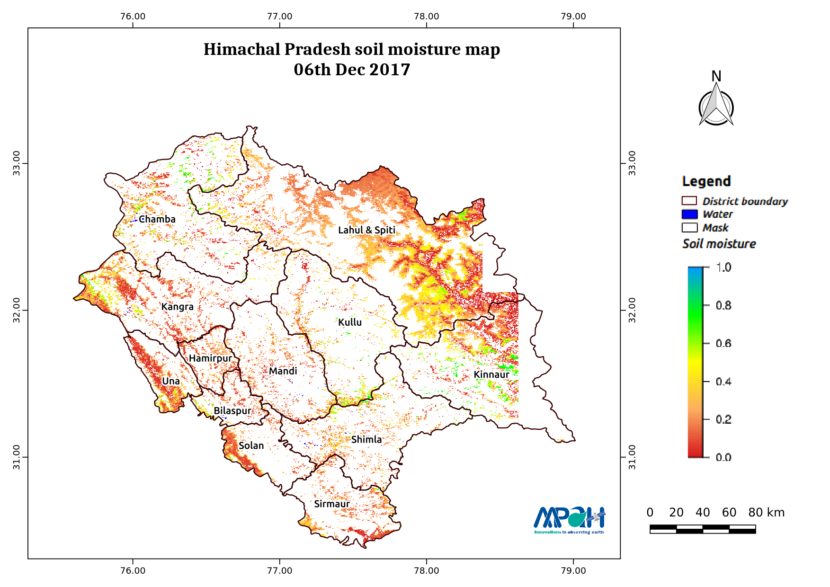
The image shows the soil moisture map for Himachal Pradesh state. The map is prepared by merging microwave and optical satellite data using the algorithm developed by us. The soil moisture maps are available daily at a spatial resolution of 500 m. The developed near real time soil moisture is helpful for: Early warning of […]

SAARC Charter day: Soil moisture using Satellite for SAARC nations

Posted on Posted in Agriculture, Algorithm Development, Crop insurance, Disaster Management, Geospatial Modelling, News, Satellite Remote Sensing, Water Resources

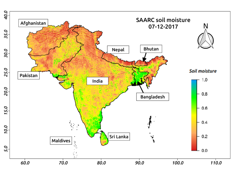
SAARC (South Asian Association for Regional Cooperation) was founded on 8th December, 1985. The member nations of this organization include Afghanistan, Bangladesh, Bhutan, India, Maldives, Nepal, Pakistan and Sri Lanka. To commemorate this 33rd SAARC Charter day, Aapah Innovations created high-resolution soil moisture map for SAARC using satellite data. Agriculture drought arises when soil moisture […]

Soil Moisture Map for the state of Gujarat

Posted on Posted in Agriculture, Algorithm Development, Disaster Management, Environment, News, Satellite Remote Sensing, Water Resources

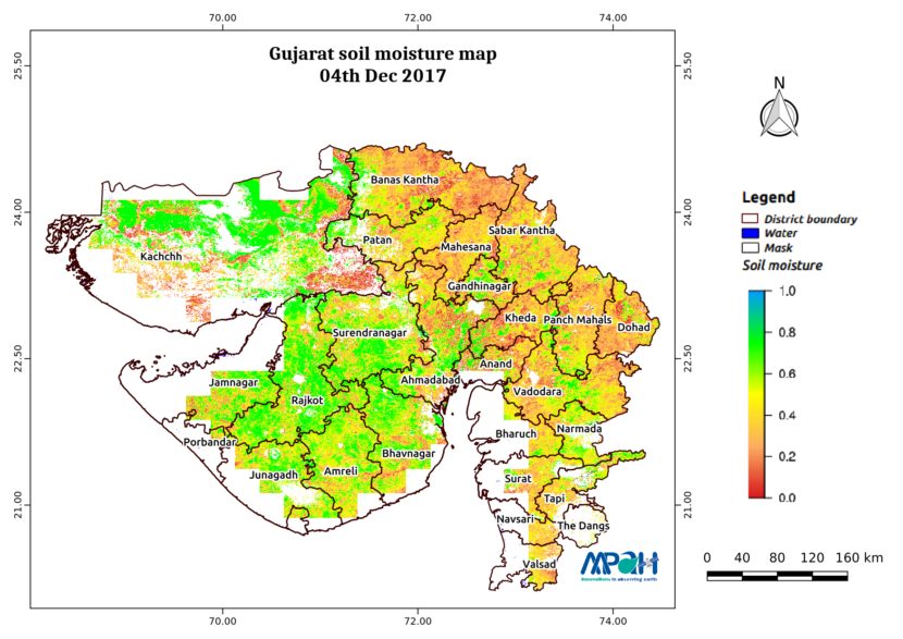
The image shows the soil moisture map for Gujarat state. The map is prepared by merging microwave and optical satellite data using the algorithm developed by us. The soil moisture maps are available daily at a spatial resolution of 500 m. The developed near real time soil moisture is helpful for: Early warning of agricultural […]