
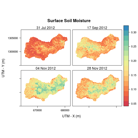
A model is developed to estimate the surface soil moisture in agricultural semi-arid area. Model is developed based on the CDF transformation approach to retrieve the surface soil moisture map for the watershed with a spatial resolution of 100 m (i.e. one hectare). The map of the uncertainty in the retrieved surface soil moisture was also estimated using the Clayton copula.


