
Cauvery basin, the one known for its bitter water dispute between the riparian states extends over states of Karnataka, Andhra Pradesh, Kerala and Union territory of Puducherry1. The issue that dates back to the pre-independence times still stand unresolved due to the lack of access to historic hydrologic data and lack of research2
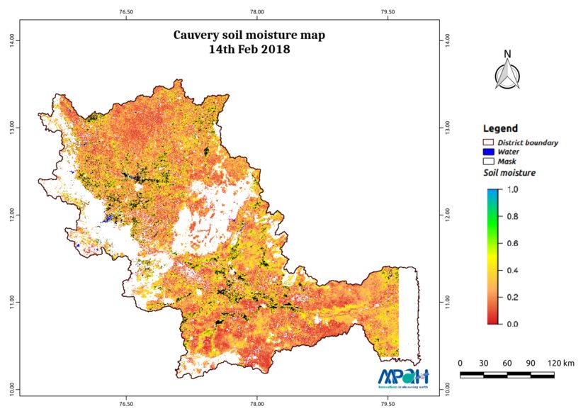
The above soil moisture map has been prepared by Aapah innovations as an attempt to make hydrologic data understandable to the public. As evident from the map shown above, the Cauvery basin has relatively less soil moisture (as on 14th February 2018).
The soil moisture is prepared by merging data from multiple satellites using the vikleda algorithm.
Some of the applications where soil moisture is useful are:
- Optimal irrigation in farms
- Identify areas being over-irrigated
- Improved flood risk estimation
- Monitor agricultural drought in near real time
- Improved weather forecast
- Analyse the impact of an irrigation project
- Identify the irrigated area by an irrigation source
- Automatic billing of farm based on the actual irrigation
- Estimation of actual evapotranspiration taking place
- Estimation of area getting degraded
To watch your region in real time, please check our app VATI.


Latest posts by Thiyaku S. (see all)
- Low Soil Moisture in Cauvery Basin: Are dry days ahead?? - February 24, 2018
- Soil Moisture Map for the state of Tamil Nadu - February 24, 2018
- Soil Moisture Map for the state of Punjab - February 21, 2018