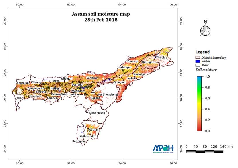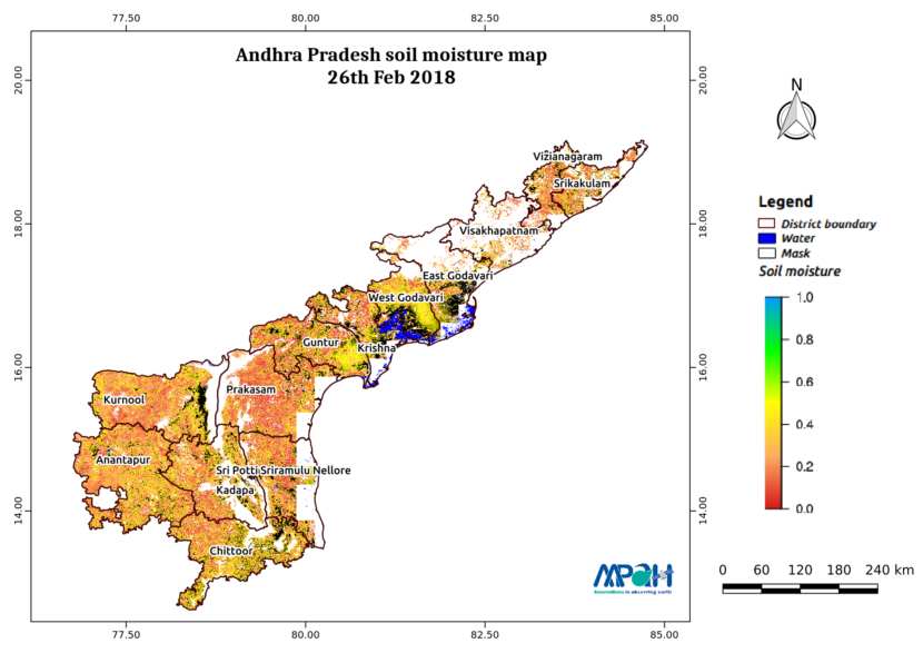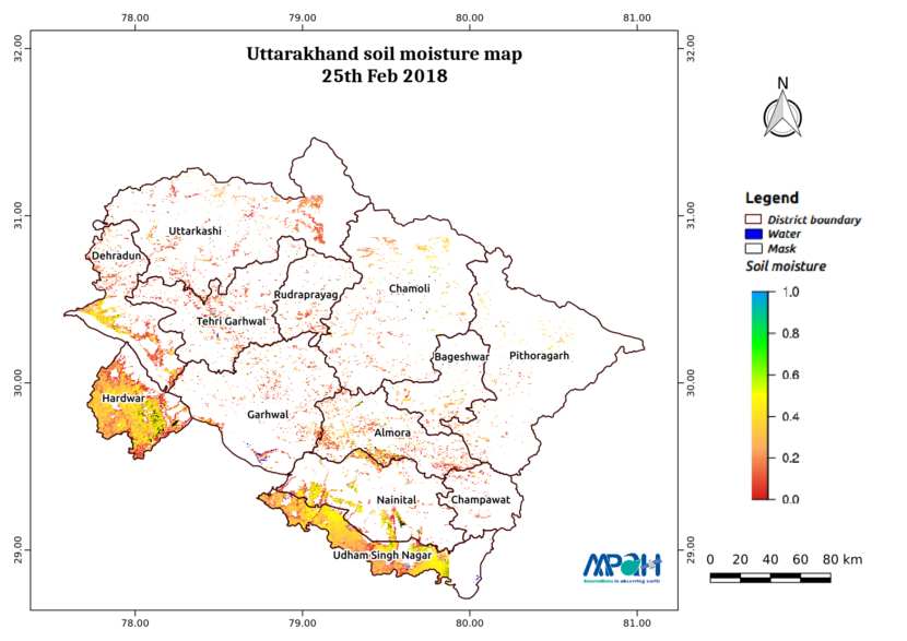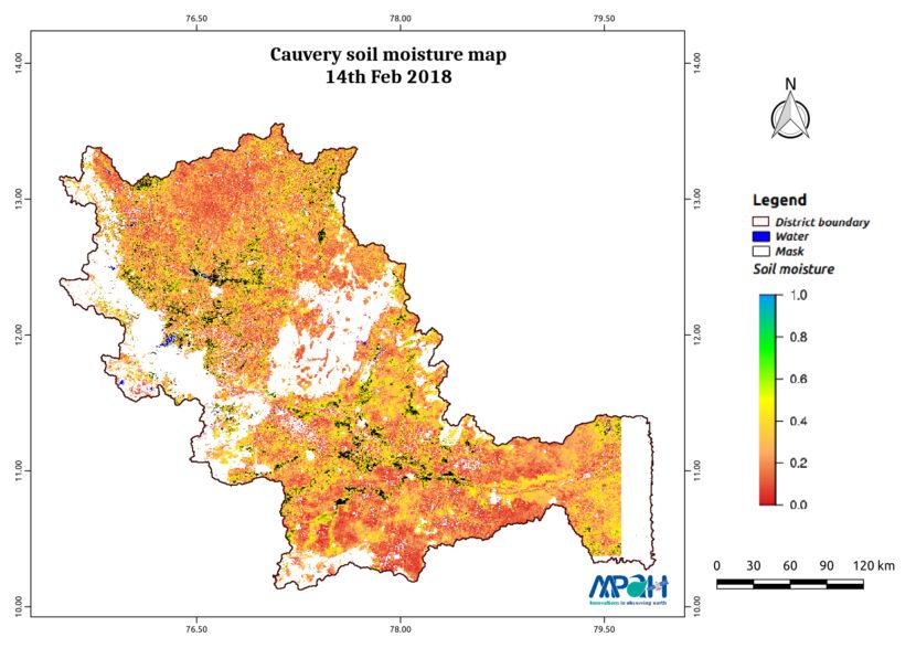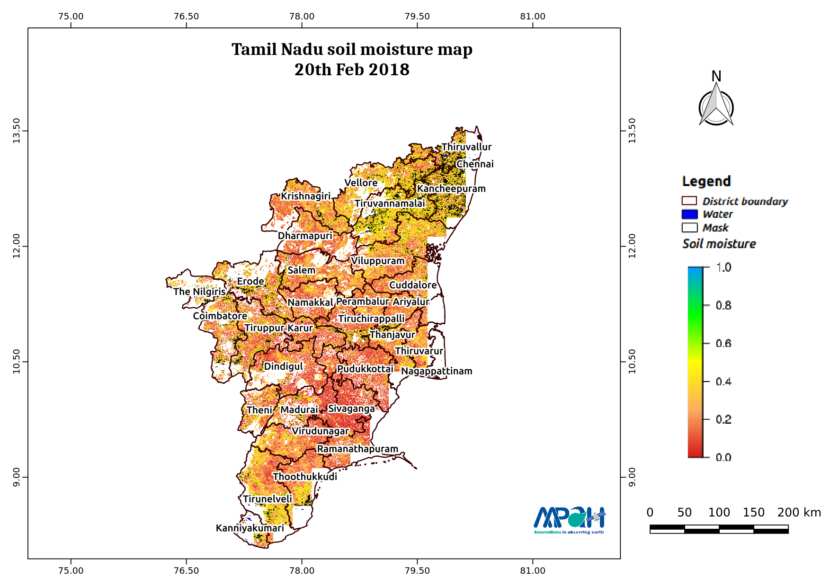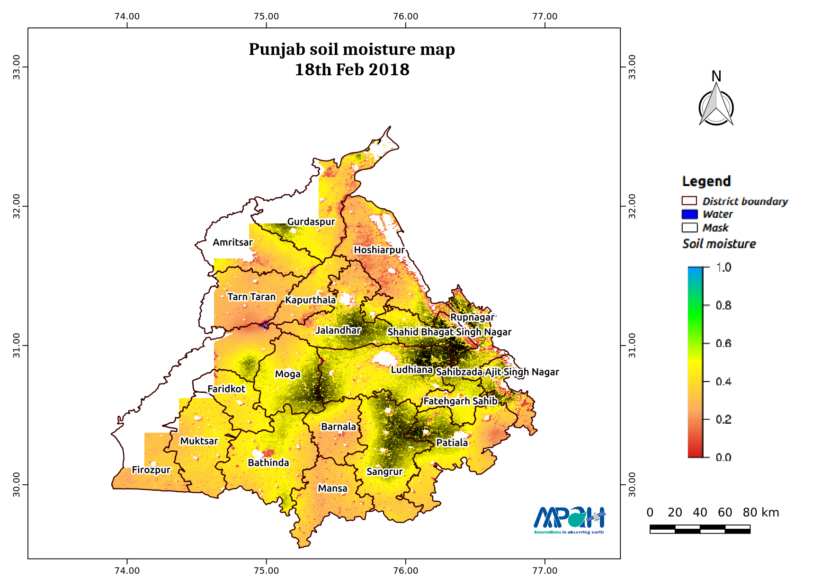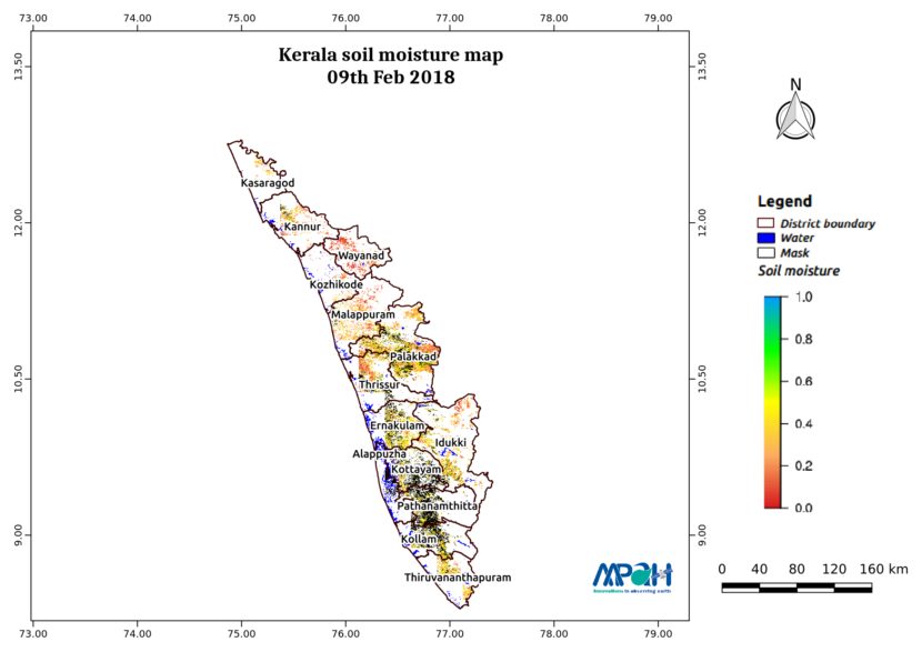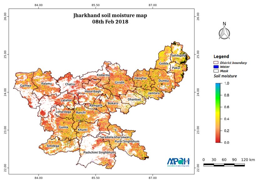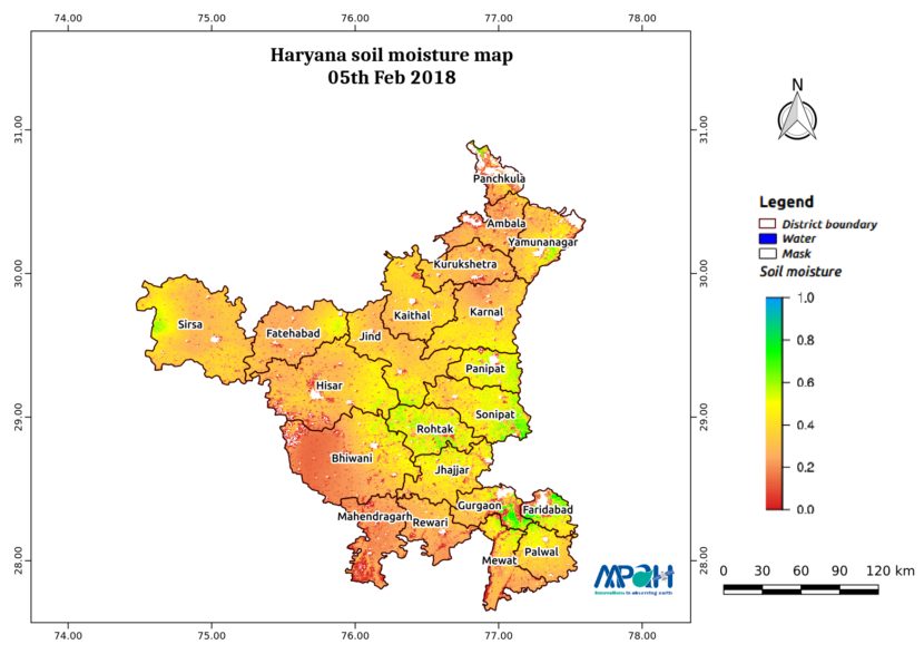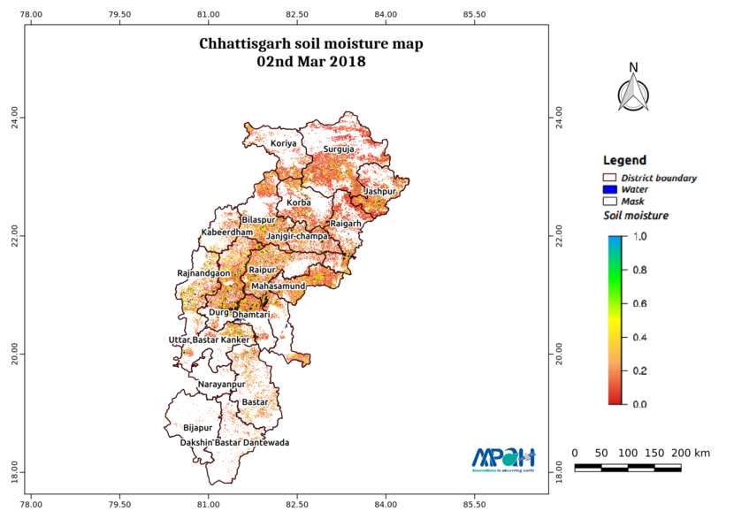
Soil Moisture Map for the state of Chhattisgarh
The image shows the soil moisture map for Chhattisgarh state for 02-Mar-2018. The map is prepared by merging data from multiple satellites using the vikleda algorithm. Some of the applications where soil moisture is useful are: Optimal irrigation in farms Identify areas being over-irrigated Improved flood risk estimation Monitor agricultural drought in near real time […]